Weather Alert in District of Columbia
Flood Watch issued June 13 at 3:45AM EDT until June 14 at 2:00AM EDT by NWS Baltimore MD/Washington DC
AREAS AFFECTED: District of Columbia; Prince Georges; Charles; St. Marys; Central and Southeast Montgomery; Albemarle; Greene; Madison; Orange; Culpeper; Fairfax; Arlington/Falls Church/Alexandria; Stafford; Spotsylvania; King George; Southern Fauquier; Central and Southeast Prince William/Manassas/Manassas Park
DESCRIPTION: * WHAT...Flash flooding caused by excessive rainfall is possible. * WHERE...Including the following , District of Columbia, including the following areas in Maryland, Central and Southeast Montgomery, Charles, Prince Georges and St. Marys, and including the following areas in Virginia, Albemarle, Arlington/Falls Church/Alexandria, Central and Southeast Prince William/Manassas/Manassas Park, Culpeper, Fairfax, Greene, King George, Madison, Orange, Southern Fauquier, Spotsylvania and Stafford. * WHEN...From this evening through late tonight. * IMPACTS...Excessive runoff may result in flooding of rivers, creeks, streams, and other low-lying and flood-prone locations. * ADDITIONAL DETAILS... - Showers and thunderstorms will increase in coverage late this afternoon through this evening. Some thunderstorms will contain heavy rainfall, with rainfall amounts around 1 to 3 inches possible within an hour or two. Storms may also train over the same areas, causing the possibility for locally higher amounts around 4 to 5 inches of rain within a few hours. Heavy rainfall in a short period of time combining with already saturated soils means that creeks and streams may rapidly rise out of their banks along with the potential for flash flooding in urban areas. - Please visit www.weather.gov/safety/flood for flood safety and preparedness information
INSTRUCTION: You should monitor later forecasts and be prepared to take action should Flash Flood Warnings be issued.
Want more detail? Get the Complete 7 Day and Night Detailed Forecast!
Current U.S. National Radar--Current
The Current National Weather Radar is shown below with a UTC Time (subtract 5 hours from UTC to get Eastern Time).

National Weather Forecast--Current
The Current National Weather Forecast and National Weather Map are shown below.

National Weather Forecast for Tomorrow
Tomorrow National Weather Forecast and Tomorrow National Weather Map are show below.

North America Water Vapor (Moisture)
This map shows recent moisture content over North America. Bright and colored areas show high moisture (ie, clouds); brown indicates very little moisture present; black indicates no moisture.

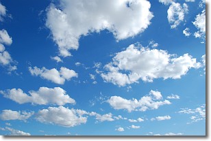
Weather Topic: What are Cumulonimbus Clouds?
Home - Education - Cloud Types - Cumulonimbus Clouds
 Next Topic: Cumulus Clouds
The final form taken by a growing cumulus cloud is the
cumulonimbus cloud, which is very tall and dense.
The tower of a cumulonimbus cloud can soar 23 km into the atmosphere, although
most commonly they stop growing at an altitude of 6 km.
Even small cumulonimbus clouds appear very large in comparison to other cloud types.
They can signal the approach of stormy weather, such as thunderstorms or blizzards.
Next Topic: Cumulus Clouds
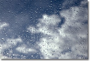
Weather Topic: What is Drizzle?
Home - Education - Precipitation - Drizzle
 Next Topic: Evaporation
Drizzle is precipitation in the form of water droplets which are
smaller than raindrops.
Drizzle is characterized by fine, gently falling droplets and typically does not
impact human habitation in a negative way. The exception to this is freezing drizzle,
a condition where drizzle freezes immediately upon reaching earth's surface.
Freezing drizzle is still less dangerous than freezing rain, but can
potentially result in hazardous road conditions.
Next Topic: Evaporation
Current conditions powered by WeatherAPI.com


