Weather Alert in New York
Special Weather Statement issued February 18 at 9:17PM EST by NWS Buffalo NY
AREAS AFFECTED: Niagara; Northern Erie; Genesee; Wyoming; Livingston; Southern Erie
DESCRIPTION: An area of thunderstorms and associated freezing rain is advancing eastward toward western New York this evening. These thunderstorms may affect the Niagara Falls and Buffalo areas by around 11 PM. Surface temperatures will be near or slightly below freezing as they cross the area, so a short period of thunder and freezing rain is possible as they move through the area. This activity will move swiftly to the southeast, so areas in southern Genesee County and Wyoming County could see a period of thunder and freezing rain around midnight. Areas in Livingston County would be affected close to 1 AM. Any areas that are below freezing may see bridges and overpasses quickly ice up. Pay attention to your local temperatures and maintain awareness for rapidly changing driving conditions in these areas.
INSTRUCTION: N/A
Want more detail? Get the Complete 7 Day and Night Detailed Forecast!
Current U.S. National Radar--Current
The Current National Weather Radar is shown below with a UTC Time (subtract 5 hours from UTC to get Eastern Time).

National Weather Forecast--Current
The Current National Weather Forecast and National Weather Map are shown below.

National Weather Forecast for Tomorrow
Tomorrow National Weather Forecast and Tomorrow National Weather Map are show below.

North America Water Vapor (Moisture)
This map shows recent moisture content over North America. Bright and colored areas show high moisture (ie, clouds); brown indicates very little moisture present; black indicates no moisture.

Weather Topic: What is Rain?
Home - Education - Precipitation - Rain
 Next Topic: Shelf Clouds
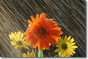
Precipitation in the form of water droplets is called rain.
Rain generally has a tendency to fall with less intensity over a greater period
of time, and when rainfall is more severe it is usually less sustained.
Rain is the most common form of precipitation and happens with greater frequency
depending on the season and regional influences. Cities have been shown to have
an observable effect on rainfall, due to an effect called the urban heat island.
Compared to upwind, monthly rainfall between twenty and forty miles downwind of
cities is 30% greater.
Next Topic: Shelf Clouds
Weather Topic: What is Sleet?
Home - Education - Precipitation - Sleet
 Next Topic: Snow
Sleet is a form of precipitation in which small ice pellets are the primary
components. These ice pellets are smaller and more translucent than hailstones,
and harder than graupel. Sleet is caused by specific atmospheric conditions and
therefore typically doesn't last for extended periods of time.
The condition which leads to sleet formation requires a warmer body of air to be
wedged in between two sub-freezing bodies of air. When snow falls through a warmer
layer of air it melts, and as it falls through the next sub-freezing body of air
it freezes again, forming ice pellets known as sleet. In some cases, water
droplets don't have time to freeze before reaching the surface and the result is
freezing rain.
Next Topic: Snow
Current conditions powered by WeatherAPI.com


