Weather Alert in Alaska
Winter Weather Advisory issued February 19 at 10:59AM AKST until February 20 at 9:00AM AKST by NWS Juneau AK
AREAS AFFECTED: Glacier Bay; Eastern Chichagof Island; Admiralty Island
DESCRIPTION: ...ACCUMULATING SNOW ACROSS THE PANHANDLE TO END THE WEEK... .A front moving across the gulf has begun to impact the panhandle with snow showers spreading along the outer coast and reaching southward to Petersburg and Wrangell as of 1045 am Thursday. The highest snow accumulations are still expected along the outer coast with orographic enhancement. A secondary batch of heavier showers will develop along the northern panhandle and progress southward as a deformation band associated with the surface low Thursday night into Friday. For inland areas, snow is expected to be light and fluffy in nature due to cold temperatures both aloft and down to the surface. Coastal communities will likely see wetter snow due to slightly warming surface temperatures through the day. * WHAT...Snow. Additional snow accumulations of 4 to 7 inches. * WHERE...Glacier Bay, Eastern Chichagof Island and Admiralty Island. * WHEN...Until 9 AM AKST Friday. * IMPACTS...Travel could be very difficult. * ADDITIONAL DETAILS...Snow showers have begun to impact the area as a frontal band pushes into the panhandle Thursday morning. Heavier snow showers are still expected to develop further inland this evening and last into Friday morning as the surface low tracks southward near the outer coast and a deformation band sets up.
INSTRUCTION: Slow down and use caution while traveling. People are urged to prepare their property before the onset of winter weather. For the latest road conditions, where available, call 5 1 1 or visit 511.alaska.gov.
Want more detail? Get the Complete 7 Day and Night Detailed Forecast!
Current U.S. National Radar--Current
The Current National Weather Radar is shown below with a UTC Time (subtract 5 hours from UTC to get Eastern Time).

National Weather Forecast--Current
The Current National Weather Forecast and National Weather Map are shown below.

National Weather Forecast for Tomorrow
Tomorrow National Weather Forecast and Tomorrow National Weather Map are show below.

North America Water Vapor (Moisture)
This map shows recent moisture content over North America. Bright and colored areas show high moisture (ie, clouds); brown indicates very little moisture present; black indicates no moisture.

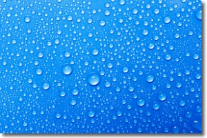
Weather Topic: What is Evaporation?
Home - Education - Precipitation - Evaporation
 Next Topic: Fog
Evaporation is the process which returns water from the earth
back to the atmosphere, and is another crucial process in the water cycle.
Evaporation is the transformation of liquid into gas, and it happens because
molecules are excited by the application of energy and turn into vapor.
In order for water to evaporate it has to be on the surface of a body of water.
Next Topic: Fog
Weather Topic: What are Fractus Clouds?
Home - Education - Cloud Types - Fractus Clouds
 Next Topic: Freezing Rain
A fractus cloud (scud) is a fragmented, tattered cloud which has
likely been sheared off of another cloud. They are accessory clouds, meaning they
develop from parent clouds, and are named in a way which describes the original
cloud which contained them.
Fractus clouds which have originated from cumulus clouds are referred to as
cumulus fractus, while fractus clouds which have originated from stratus clouds
are referred to as stratus fractus. Under certain conditions a fractus cloud might
merge with another cloud, or develop into a cumulus cloud, but usually a
fractus cloud seen by itself will dissipate rapidly.
They are often observed on the leading and trailing edges of storm clouds,
and are a display of wind activity.
Next Topic: Freezing Rain
Current conditions powered by WeatherAPI.com


