Weather Alert in Arkansas
Flood Advisory issued April 27 at 10:25AM CDT until April 30 at 1:00AM CDT by NWS Memphis TN
AREAS AFFECTED: Crittenden, AR; DeSoto, MS; Shelby, TN
DESCRIPTION: ...The Flood Advisory continues for the following rivers in Tennessee...Missouri...Arkansas...Mississippi... Mississippi River at Caruthersville Mississippi River at Helena Mississippi River at Memphis For the Lower Mississippi River...including Tiptonville, Caruthersville, Osceola, Memphis, Tunica Mhoon Landing, Helena... elevated river levels are forecast. * WHAT...Flooding caused by excessive rainfall continues. * WHERE...Mississippi River at Memphis. * WHEN...Until early Wednesday morning. * IMPACTS...At 32.0 feet, In Arkansas, the road to the dwelling on the south end of Island 40 Chute is flooding. The levee near Danner Lake has water on it. Water is up to most of the levee west of Island 40 Chute and on south to I-55. Most land between Memphis and West Memphis is covered by water. * ADDITIONAL DETAILS... - At 10:00 AM CDT Sunday the stage was 31.2 feet. - Forecast...The river is expected to continue falling. - Action stage is 28.0 feet. - Flood stage is 34.0 feet. - http://www.weather.gov/safety/flood
INSTRUCTION: Caution is urged when walking near riverbanks. Additional information is available at weather.gov/memphis. The next statement will be issued as needed.
Want more detail? Get the Complete 7 Day and Night Detailed Forecast!
Current U.S. National Radar--Current
The Current National Weather Radar is shown below with a UTC Time (subtract 5 hours from UTC to get Eastern Time).

National Weather Forecast--Current
The Current National Weather Forecast and National Weather Map are shown below.

National Weather Forecast for Tomorrow
Tomorrow National Weather Forecast and Tomorrow National Weather Map are show below.

North America Water Vapor (Moisture)
This map shows recent moisture content over North America. Bright and colored areas show high moisture (ie, clouds); brown indicates very little moisture present; black indicates no moisture.

Weather Topic: What are Stratocumulus Clouds?
Home - Education - Cloud Types - Stratocumulus Clouds
 Next Topic: Stratus Clouds
Stratocumulus clouds are similar to altocumulus clouds in their
fluffy appearance, but have a slightly darker shade due to their additional mass.
A good way to distinguish the two cloud types is to hold your hand out and measure
the size of an individual cloud; if it is the size of your thumb it is generally
an altocumulus cloud, if it is the size of your hand it is generally a
stratocumulus cloud.
It is uncommon for stratocumulus clouds to produce precipitation, but if they do
it is usually a light rain or snow.
Next Topic: Stratus Clouds
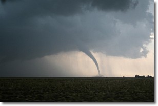
Weather Topic: What are Wall Clouds?
Home - Education - Cloud Types - Wall Clouds
 Next Topic: Altocumulus Clouds
A wall cloud forms underneath the base of a cumulonimbus cloud,
and can be a hotbed for deadly tornadoes.
Wall clouds are formed by air flowing into the cumulonimbus clouds, which can
result in the wall cloud descending from the base of the cumulonimbus cloud, or
rising fractus clouds which join to the base of the storm cloud as the wall cloud
takes shape.
Wall clouds can be very large, and in the Northern Hemisphere they generally
form at the southern edge of cumulonimbus clouds.
Next Topic: Altocumulus Clouds
Current conditions powered by WeatherAPI.com


