Weather Alert in North Carolina
Winter Weather Advisory issued February 21 at 7:09PM EST until February 24 at 12:00AM EST by NWS Blacksburg VA
AREAS AFFECTED: Ashe; Watauga; Smyth; Grayson
DESCRIPTION: Low pressure will pass over the region tonight and Sunday with rain changing to snow across the higher elevations. Arrival of colder air Sunday along with the development of a strong winter storm along the coastal mid-atlantic will result in an extended period of snow across the mountains Sunday night through Monday. * WHAT...Snow expected. Total snow accumulations up to 4 inches. Locally higher amounts at elevations above 4000 feet. Winds gusting as high as 45 mph. * WHERE...In North Carolina, Ashe and Watauga Counties. In Virginia, Grayson and Smyth Counties. * WHEN...From midnight tonight to midnight EST Monday Night. * IMPACTS...Travel could be very difficult. The hazardous conditions could impact the Monday morning and evening commutes. Gusty winds could bring down tree branches. * ADDITIONAL DETAILS...Temperatures are expected to fall into the teens Sunday night with wind chills in the single digits.
INSTRUCTION: Slow down and use caution while traveling. The latest road conditions for the state you are calling from can be obtained by calling 5 1 1.
Want more detail? Get the Complete 7 Day and Night Detailed Forecast!
Current U.S. National Radar--Current
The Current National Weather Radar is shown below with a UTC Time (subtract 5 hours from UTC to get Eastern Time).

National Weather Forecast--Current
The Current National Weather Forecast and National Weather Map are shown below.

National Weather Forecast for Tomorrow
Tomorrow National Weather Forecast and Tomorrow National Weather Map are show below.

North America Water Vapor (Moisture)
This map shows recent moisture content over North America. Bright and colored areas show high moisture (ie, clouds); brown indicates very little moisture present; black indicates no moisture.

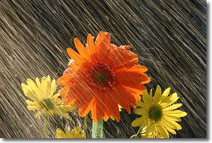
Weather Topic: What is Rain?
Home - Education - Precipitation - Rain
 Next Topic: Shelf Clouds
Precipitation in the form of water droplets is called rain.
Rain generally has a tendency to fall with less intensity over a greater period
of time, and when rainfall is more severe it is usually less sustained.
Rain is the most common form of precipitation and happens with greater frequency
depending on the season and regional influences. Cities have been shown to have
an observable effect on rainfall, due to an effect called the urban heat island.
Compared to upwind, monthly rainfall between twenty and forty miles downwind of
cities is 30% greater.
Next Topic: Shelf Clouds
Weather Topic: What is Sleet?
Home - Education - Precipitation - Sleet
 Next Topic: Snow
Sleet is a form of precipitation in which small ice pellets are the primary
components. These ice pellets are smaller and more translucent than hailstones,
and harder than graupel. Sleet is caused by specific atmospheric conditions and
therefore typically doesn't last for extended periods of time.
The condition which leads to sleet formation requires a warmer body of air to be
wedged in between two sub-freezing bodies of air. When snow falls through a warmer
layer of air it melts, and as it falls through the next sub-freezing body of air
it freezes again, forming ice pellets known as sleet. In some cases, water
droplets don't have time to freeze before reaching the surface and the result is
freezing rain.
Next Topic: Snow
Current conditions powered by WeatherAPI.com


