Weather Alert in Texas
Severe Thunderstorm Warning issued March 8 at 12:08AM CST until March 8 at 12:45AM CST by NWS Brownsville TX
AREAS AFFECTED: Starr, TX
DESCRIPTION: SVRBRO The National Weather Service in Brownsville has issued a * Severe Thunderstorm Warning for... Southeastern Starr County in Deep South Texas... * Until 1245 AM CST. * At 1207 AM CST, a severe thunderstorm was located over Las Lomas, or near Garciasville, moving east at 25 mph. THIS IS A DESTRUCTIVE STORM FOR STARR COUNTY!. HAZARD...Three inch hail and 60 mph wind gusts. SOURCE...Radar indicated. IMPACT...People and animals outdoors will be severely injured. Expect shattered windows, extensive damage to roofs, siding, and vehicles. * Locations impacted include... Rio Grande City, Sullivan City, Garciasville, La Grulla, La Puerta, Ringgold Middle School, La Victoria, Fort Ringgold County Park, Starr County Sheriffs Office, and Alto Bonito.
INSTRUCTION: Prepare immediately for large hail and deadly cloud to ground lightning. Seek shelter inside a well-built structure. Stay away from windows. This is a dangerous storm. Prepare immediately for large destructive hail capable of producing significant damage. People outside should move to shelter inside a strong building, and stay away from windows. This storm is producing destructive winds and large damaging hail. SEEK SHELTER NOW inside a sturdy structure and stay away from windows! This is a dangerous storm, capable of producing large hail driven by severe winds! SEEK SHELTER NOW inside a sturdy structure and stay away from windows! If you are caught outdoors, cover your head and neck. Torrential rainfall is occurring with this storm, and may lead to flash flooding. Do not drive your vehicle through flooded roadways.
Want more detail? Get the Complete 7 Day and Night Detailed Forecast!
Current U.S. National Radar--Current
The Current National Weather Radar is shown below with a UTC Time (subtract 5 hours from UTC to get Eastern Time).

National Weather Forecast--Current
The Current National Weather Forecast and National Weather Map are shown below.

National Weather Forecast for Tomorrow
Tomorrow National Weather Forecast and Tomorrow National Weather Map are show below.

North America Water Vapor (Moisture)
This map shows recent moisture content over North America. Bright and colored areas show high moisture (ie, clouds); brown indicates very little moisture present; black indicates no moisture.

Weather Topic: What is Rain?
Home - Education - Precipitation - Rain
 Next Topic: Shelf Clouds
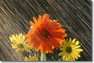
Precipitation in the form of water droplets is called rain.
Rain generally has a tendency to fall with less intensity over a greater period
of time, and when rainfall is more severe it is usually less sustained.
Rain is the most common form of precipitation and happens with greater frequency
depending on the season and regional influences. Cities have been shown to have
an observable effect on rainfall, due to an effect called the urban heat island.
Compared to upwind, monthly rainfall between twenty and forty miles downwind of
cities is 30% greater.
Next Topic: Shelf Clouds
Weather Topic: What is Sleet?
Home - Education - Precipitation - Sleet
 Next Topic: Snow
Sleet is a form of precipitation in which small ice pellets are the primary
components. These ice pellets are smaller and more translucent than hailstones,
and harder than graupel. Sleet is caused by specific atmospheric conditions and
therefore typically doesn't last for extended periods of time.
The condition which leads to sleet formation requires a warmer body of air to be
wedged in between two sub-freezing bodies of air. When snow falls through a warmer
layer of air it melts, and as it falls through the next sub-freezing body of air
it freezes again, forming ice pellets known as sleet. In some cases, water
droplets don't have time to freeze before reaching the surface and the result is
freezing rain.
Next Topic: Snow
Current conditions powered by WeatherAPI.com


