Weather Alert in Alaska
Flood Watch issued August 2 at 7:09AM AKDT until August 4 at 3:00PM AKDT by NWS Anchorage AK
AREAS AFFECTED: Lower Matanuska Valley; Sutton / Upper Matanuska Valley; Eureka / Tahneta Pass
DESCRIPTION: * WHAT...Flooding caused by excessive rainfall is possible. * WHERE...The lower Matanuska River near Butte and Palmer as well as small rivers and streams between Sutton and Eureka. * WHEN...Through Monday afternoon. * IMPACTS...Heavy rainfall will lead to rapid runoff and rises in small streams draining the steep terrain along the Glenn Highway between Sutton and Eureka. Landslides are possible in landslide-prone areas along this corridor. Significant runoff is also expected to raise water levels on the Matanuska River, with some locations approaching bankfull by early Sunday morning. River levels may approach or even exceed those observed in early July, with increased bank erosion expected along the lower Matanuska River. While water levels may rise in small streams and rivers across the Matanuska-Susitna Valley, flooding is not expected west of the lower Matanuska River. * ADDITIONAL DETAILS... - Rain will continue across the western Copper River Basin and northern Matanuska Valley Saturday morning through Sunday morning. As of 4 AM this morning, 1.00" to 1.25" inches of rain has already fallen across the area. An additional 0.50" to 1.00" of rain is possible through Sunday morning, with projected rainfall totals with this storm likely around 1 to 2 inches from Mendeltna to Sutton. Precipitation will be enhanced near terrain and along the northeast facing slopes of the Talkeetna and Chugach mountains. The heaviest rainfall is expected within the mountainous terrain along the Glenn Highway corridor between Sutton and Eureka. Ponding of water on roadways and erosion of unpaved surfaces is also possible. As of 4 AM Saturday morning, the Matanuska River at Palmer (MATA2) is at 16800 cfs and is expected to crest Sunday morning at 25100 cfs, which is below minor flood stage (30000 cfs). - Http://www.weather.gov/safety/flood - If you live near or along the Matanuska River, stay alert and be prepared to take action. - All residents on or near mountain slopes should be prepared for possible landslides.
INSTRUCTION: Persons living along streams should stay alert and be prepared to take action if a warning or advisory is issued, or flooding is observed. You should monitor later forecasts and be alert for possible Flood Warnings. Those living in areas prone to flooding should be prepared to take action should flooding develop. Stay tuned to further developments by listening to your local radio, television, or NOAA Weather Radio for further information. Reports on river conditions can be sent to the River Forecast Center by calling 1-800-847-1739
Want more detail? Get the Complete 7 Day and Night Detailed Forecast!
Current U.S. National Radar--Current
The Current National Weather Radar is shown below with a UTC Time (subtract 5 hours from UTC to get Eastern Time).

National Weather Forecast--Current
The Current National Weather Forecast and National Weather Map are shown below.

National Weather Forecast for Tomorrow
Tomorrow National Weather Forecast and Tomorrow National Weather Map are show below.

North America Water Vapor (Moisture)
This map shows recent moisture content over North America. Bright and colored areas show high moisture (ie, clouds); brown indicates very little moisture present; black indicates no moisture.

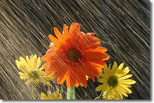
Weather Topic: What is Rain?
Home - Education - Precipitation - Rain
 Next Topic: Shelf Clouds
Precipitation in the form of water droplets is called rain.
Rain generally has a tendency to fall with less intensity over a greater period
of time, and when rainfall is more severe it is usually less sustained.
Rain is the most common form of precipitation and happens with greater frequency
depending on the season and regional influences. Cities have been shown to have
an observable effect on rainfall, due to an effect called the urban heat island.
Compared to upwind, monthly rainfall between twenty and forty miles downwind of
cities is 30% greater.
Next Topic: Shelf Clouds
Weather Topic: What is Sleet?
Home - Education - Precipitation - Sleet
 Next Topic: Snow
Sleet is a form of precipitation in which small ice pellets are the primary
components. These ice pellets are smaller and more translucent than hailstones,
and harder than graupel. Sleet is caused by specific atmospheric conditions and
therefore typically doesn't last for extended periods of time.
The condition which leads to sleet formation requires a warmer body of air to be
wedged in between two sub-freezing bodies of air. When snow falls through a warmer
layer of air it melts, and as it falls through the next sub-freezing body of air
it freezes again, forming ice pellets known as sleet. In some cases, water
droplets don't have time to freeze before reaching the surface and the result is
freezing rain.
Next Topic: Snow
Current conditions powered by WeatherAPI.com


