Weather Alert in South Carolina
Flash Flood Warning issued August 22 at 6:47PM EDT until August 22 at 8:15PM EDT by NWS Charleston SC
AREAS AFFECTED: Berkeley, SC; Charleston, SC; Dorchester, SC
DESCRIPTION: At 647 PM EDT, emergency management officials reported flash flooding is still ongoing across much of the Charleston Metro Area. Many roads are reported closed and flooded across Downtown Charleston, North Charleston and surrounding communities. Radar shows bands of moderate to locally heavy rain expanding across the Metro area again. This will worsen ongoing flash flooding, especially as an elevated high tide approaches. As much as 3 to 6 inches have fallen so far today. An additional inch could fall. Tides in the Charleston Harbor are expected to reach between 7.7 and 7.9 ft MLLW, which is well into the moderate flood range. With drainage systems full of saltwater, any heavy rainfall that falls will immediately result in additional flooding. In addition, people along Church Creek in West Ashley should carefully monitor water levels this evening. Flooding could develop in neighborhoods near the creek, including areas along Winners Circle. HAZARD...Life threatening flash flooding. Thunderstorms producing flash flooding. SOURCE...Emergency management reported. IMPACT...Life threatening flash flooding of creeks and streams, urban areas, highways, streets and underpasses. Some locations that will experience flash flooding include... North Charleston, Mount Pleasant, Goose Creek, Hanahan, West Ashley, Downtown Charleston, I-26/I-526 Interchange, James Island, Johns Island and Daniel Island. This includes the following highways... I-26 between mile markers 208 and 221. I-526 between mile markers 11 and 29.
INSTRUCTION: Turn around, don't drown when encountering flooded roads. Most flood deaths occur in vehicles. Report flooding directly to the Charleston National Weather Service at 1-888-383-2024 or email your reports to nws.charlestonsc@noaa.gov.
Want more detail? Get the Complete 7 Day and Night Detailed Forecast!
Current U.S. National Radar--Current
The Current National Weather Radar is shown below with a UTC Time (subtract 5 hours from UTC to get Eastern Time).

National Weather Forecast--Current
The Current National Weather Forecast and National Weather Map are shown below.

National Weather Forecast for Tomorrow
Tomorrow National Weather Forecast and Tomorrow National Weather Map are show below.

North America Water Vapor (Moisture)
This map shows recent moisture content over North America. Bright and colored areas show high moisture (ie, clouds); brown indicates very little moisture present; black indicates no moisture.

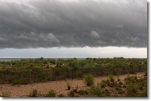
Weather Topic: What are Shelf Clouds?
Home - Education - Cloud Types - Shelf Clouds
 Next Topic: Sleet
A shelf cloud is similar to a wall cloud, but forms at the front
of a storm cloud, instead of at the rear, where wall clouds form.
A shelf cloud is caused by a series of events set into motion by the advancing
storm; first, cool air settles along the ground where precipitation has just fallen.
As the cool air is brought in, the warmer air is displaced, and rises above it,
because it is less dense. When the warmer air reaches the bottom of the storm cloud,
it begins to cool again, and the resulting condensation is a visible shelf cloud.
Next Topic: Sleet
Weather Topic: What is Snow?
Home - Education - Precipitation - Snow
 Next Topic: Stratocumulus Clouds
Snow is precipitation taking the form of ice crystals. Each ice crystal, or snowflake,
has unique characteristics, but all of them grow in a hexagonal structure.
Snowfall can last for sustained periods of time and result in significant buildup
of snow on the ground.
On the earth's surface, snow starts out light and powdery, but as it begins to melt
it tends to become more granular, producing small bits of ice which have the consistency of
sand. After several cycles of melting and freezing, snow can become very dense
and ice-like, commonly known as snow pack.
Next Topic: Stratocumulus Clouds
Current conditions powered by WeatherAPI.com


