Weather Alert in Missouri
Flood Warning issued April 3 at 8:23AM CDT until April 4 at 5:13PM CDT by NWS Kansas City/Pleasant Hill MO
AREAS AFFECTED: Bates, MO; Cass, MO; Henry, MO
DESCRIPTION: ...The Flood Warning continues for the following rivers in Missouri... Big Creek at Blairstown affecting Johnson, Henry and Cass Counties. ...The Flood Warning is extended for the following rivers in Missouri... Blackwater River near Blue Lick affecting Cooper and Saline Counties. Blackwater River at Valley City affecting Johnson and Pettis Counties. Lamine River near Otterville affecting Cooper County. Petite Saline Creek near Boonville affecting Cooper County. South Grand River at Urich affecting Henry, Cass and Bates Counties. Wakenda Creek at Carrollton affecting Carroll County. * WHAT...Moderate flooding is occurring and minor flooding is forecast. * WHERE...South Grand River at Urich. * WHEN...Until tomorrow afternoon. * IMPACTS...At 24.0 feet, Flooding occurs across locations within 0.5 to 1.5 miles of the river. Areas affected include low lying pastures along with cropland and secondary roads. At 28.0 feet, K Highway is under water approximately 1 mile south of Urich. Many other roads along the river are flooded as well. * ADDITIONAL DETAILS... - At 8:15 AM CDT Friday the stage was 27.1 feet. - Forecast...The river is expected to fall below flood stage late this afternoon and continue falling to 5.5 feet Wednesday morning. - Flood stage is 24.0 feet. - http://www.weather.gov/safety/flood
INSTRUCTION: Turn around, don't drown when encountering flooded roads. Most flood deaths occur in vehicles. This product along with additional weather and stream information is available at www.weather.gov/kc/.
Want more detail? Get the Complete 7 Day and Night Detailed Forecast!
Current U.S. National Radar--Current
The Current National Weather Radar is shown below with a UTC Time (subtract 5 hours from UTC to get Eastern Time).

National Weather Forecast--Current
The Current National Weather Forecast and National Weather Map are shown below.

National Weather Forecast for Tomorrow
Tomorrow National Weather Forecast and Tomorrow National Weather Map are show below.

North America Water Vapor (Moisture)
This map shows recent moisture content over North America. Bright and colored areas show high moisture (ie, clouds); brown indicates very little moisture present; black indicates no moisture.

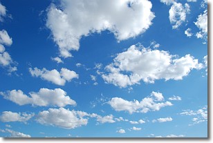
Weather Topic: What are Cumulonimbus Clouds?
Home - Education - Cloud Types - Cumulonimbus Clouds
 Next Topic: Cumulus Clouds
The final form taken by a growing cumulus cloud is the
cumulonimbus cloud, which is very tall and dense.
The tower of a cumulonimbus cloud can soar 23 km into the atmosphere, although
most commonly they stop growing at an altitude of 6 km.
Even small cumulonimbus clouds appear very large in comparison to other cloud types.
They can signal the approach of stormy weather, such as thunderstorms or blizzards.
Next Topic: Cumulus Clouds
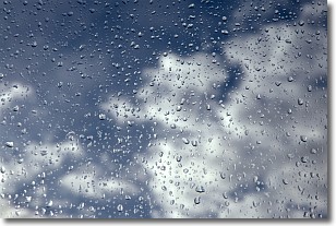
Weather Topic: What is Drizzle?
Home - Education - Precipitation - Drizzle
 Next Topic: Evaporation
Drizzle is precipitation in the form of water droplets which are
smaller than raindrops.
Drizzle is characterized by fine, gently falling droplets and typically does not
impact human habitation in a negative way. The exception to this is freezing drizzle,
a condition where drizzle freezes immediately upon reaching earth's surface.
Freezing drizzle is still less dangerous than freezing rain, but can
potentially result in hazardous road conditions.
Next Topic: Evaporation
Current conditions powered by WeatherAPI.com


