Weather Alert in Wyoming
Air Quality Alert issued August 21 at 10:45PM MDT by NWS Riverton WY
AREAS AFFECTED: Southwest Bighorn Basin
DESCRIPTION: The following message is transmitted on behalf of the Wyoming Department of Environmental Quality, Air Quality Division, and the Wyoming Department of Health. * WHAT...Air Quality Alert for Wildfire Smoke. * WHERE...Hot Springs County, mainly near the Red Canyon Wildfire in eastern Hot Springs County. * WHEN...1 PM Thursday August 21 through 1 PM Friday August 22. * IMPACTS...Smoke from the Red Canyon Fire, will continue to spread across the area today into Friday morning. HEALTH INFORMATION...The Wyoming Department of Health recommends that the elderly, young children, and individuals with respiratory problems avoid excessive physical exertion and minimize outdoor activities during this time. Wildfire smoke is made up of a variety of pollutants, including particulate matter and ozone, which can cause respiratory health effects. Although these people are most susceptible to health impacts, the Department of Health also advises that everyone should avoid prolonged exposure to poor air quality conditions. CURRENT CONDITIONS...The Wyoming Department of Environmental Quality, Air Quality Division offers near real-time air quality data for Wyoming's monitoring stations and health effects information to help the public interpret current conditions. Current air quality conditions across the state of Wyoming can be found at http://www.wyvisnet.com/.
INSTRUCTION: N/A
Want more detail? Get the Complete 7 Day and Night Detailed Forecast!
Current U.S. National Radar--Current
The Current National Weather Radar is shown below with a UTC Time (subtract 5 hours from UTC to get Eastern Time).

National Weather Forecast--Current
The Current National Weather Forecast and National Weather Map are shown below.

National Weather Forecast for Tomorrow
Tomorrow National Weather Forecast and Tomorrow National Weather Map are show below.

North America Water Vapor (Moisture)
This map shows recent moisture content over North America. Bright and colored areas show high moisture (ie, clouds); brown indicates very little moisture present; black indicates no moisture.

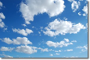
Weather Topic: What are Cumulonimbus Clouds?
Home - Education - Cloud Types - Cumulonimbus Clouds
 Next Topic: Cumulus Clouds
The final form taken by a growing cumulus cloud is the
cumulonimbus cloud, which is very tall and dense.
The tower of a cumulonimbus cloud can soar 23 km into the atmosphere, although
most commonly they stop growing at an altitude of 6 km.
Even small cumulonimbus clouds appear very large in comparison to other cloud types.
They can signal the approach of stormy weather, such as thunderstorms or blizzards.
Next Topic: Cumulus Clouds
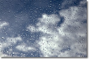
Weather Topic: What is Drizzle?
Home - Education - Precipitation - Drizzle
 Next Topic: Evaporation
Drizzle is precipitation in the form of water droplets which are
smaller than raindrops.
Drizzle is characterized by fine, gently falling droplets and typically does not
impact human habitation in a negative way. The exception to this is freezing drizzle,
a condition where drizzle freezes immediately upon reaching earth's surface.
Freezing drizzle is still less dangerous than freezing rain, but can
potentially result in hazardous road conditions.
Next Topic: Evaporation
Current conditions powered by WeatherAPI.com


