Weather Alert in North Carolina
Special Weather Statement issued February 5 at 8:16PM EST by NWS Newport/Morehead City NC
AREAS AFFECTED: Beaufort; Mainland Hyde; Jones; Pamlico; Northern Craven; Southern Craven; West Carteret; East Carteret; Inland Onslow; Coastal Onslow
DESCRIPTION: The mix of rain, snow, sleet, and ice pellets, has further dampened the ground near the Crystal Coast this evening resulting in fairly widespread wet spots across portions of Onslow to Carteret County and areas north to Beaufort and mainland Hyde Counties. With temps quickly forecast to fall below freezing tonight, don't think these more widespread wet spots will dry in time, so black ice has become a concern. This threat will last until about 9AM before temps quickly warm above freezing and the black ice threat greatly lowers. Biggest areas of concern will be across bridges, overpasses, and any elevated roadways. Thin sheets of ice, called black ice, may be difficult to see, especially during the pre-dawn hours. They may appear to be wet spots on the road. Motorists will have a difficult time determining which spots are just wet and which are icy. Motorists are advised to use extra caution. Allow ample distance between yourself and other vehicles, to avoid the risk of a collision if slippery conditions are encountered. Allow a little extra time to reach your destination safely.
INSTRUCTION: N/A
Want more detail? Get the Complete 7 Day and Night Detailed Forecast!
Current U.S. National Radar--Current
The Current National Weather Radar is shown below with a UTC Time (subtract 5 hours from UTC to get Eastern Time).

National Weather Forecast--Current
The Current National Weather Forecast and National Weather Map are shown below.

National Weather Forecast for Tomorrow
Tomorrow National Weather Forecast and Tomorrow National Weather Map are show below.

North America Water Vapor (Moisture)
This map shows recent moisture content over North America. Bright and colored areas show high moisture (ie, clouds); brown indicates very little moisture present; black indicates no moisture.

Weather Topic: What are Wall Clouds?
Home - Education - Cloud Types - Wall Clouds
 Next Topic: Altocumulus Clouds
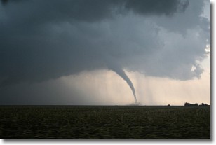
A wall cloud forms underneath the base of a cumulonimbus cloud,
and can be a hotbed for deadly tornadoes.
Wall clouds are formed by air flowing into the cumulonimbus clouds, which can
result in the wall cloud descending from the base of the cumulonimbus cloud, or
rising fractus clouds which join to the base of the storm cloud as the wall cloud
takes shape.
Wall clouds can be very large, and in the Northern Hemisphere they generally
form at the southern edge of cumulonimbus clouds.
Next Topic: Altocumulus Clouds
Weather Topic: What are Altostratus Clouds?
Home - Education - Cloud Types - Altostratus Clouds
 Next Topic: Cirrocumulus Clouds
Altostratus clouds form at mid to high-level altitudes
(between 2 and 7 km) and are created by a warm, stable air mass which causes
water vapor
to condense as it rise through the atmosphere. Usually altostratus clouds are
featureless sheets characterized by a uniform color.
In some cases, wind punching through the cloud formation may give it a waved
appearance, called altostratus undulatus. Altostratus clouds
are commonly seen with other cloud formations accompanying them.
Next Topic: Cirrocumulus Clouds
Current conditions powered by WeatherAPI.com


