Weather Alert in California
Winter Storm Warning issued February 18 at 2:32PM PST until February 19 at 10:00AM PST by NWS Medford OR
AREAS AFFECTED: South Central Siskiyou County; North Central and Southeast Siskiyou County
DESCRIPTION: ...ANOTHER EPISODE OF LOW ELEVATION SNOW LATE TONIGHT INTO THURSDAY... .Scattered to numerous light snow showers will persist through this evening with snow levels around 1500 to 2000 feet and accumulation of up to 2 inches. The next cold front will follow with widespread accumulations of snow late tonight into Thursday morning and snow levels around 1000 to 1500 feet. Light snow showers will then taper off into Thursday afternoon while snow levels rise to 2000 feet, except for snow showers lingering into Thursday evening for eastern Klamath, Lake, and Modoc Counties. * WHAT...Heavy snow. Additional snow accumulations 4 to 12 inches, except up to 20 inches for the high terrain. A majority of the snow is expected from Midnight to 8 AM PST on Thursday morning, with light snow showers then tapering off through the morning. * WHERE...Southern and eastern Siskiyou County. This includes Highways 97 and 89, Interstate 5 south of Weed, Black Butte Summit, Snowman Summit, Dead Horse Summit, Grass Lake Summit and Mt Shasta Ski Park Road. This also includes the communities of Mt Shasta City, Dunsmuir, McCloud and Tennant. * WHEN...Until 10 AM PST Thursday. * IMPACTS...Travel may be very difficult to impossible. The hazardous conditions could impact the Thursday morning commute. * ADDITIONAL DETAILS... Visit weather.gov/mfr/winter for additional snow probabilities
INSTRUCTION: If you must travel, keep an extra flashlight, food, and water in your vehicle in case of an emergency. Call 511 or visit quickmap.dot.ca.gov for road information.
Want more detail? Get the Complete 7 Day and Night Detailed Forecast!
Current U.S. National Radar--Current
The Current National Weather Radar is shown below with a UTC Time (subtract 5 hours from UTC to get Eastern Time).

National Weather Forecast--Current
The Current National Weather Forecast and National Weather Map are shown below.

National Weather Forecast for Tomorrow
Tomorrow National Weather Forecast and Tomorrow National Weather Map are show below.

North America Water Vapor (Moisture)
This map shows recent moisture content over North America. Bright and colored areas show high moisture (ie, clouds); brown indicates very little moisture present; black indicates no moisture.

Weather Topic: What are Cirrus Clouds?
Home - Education - Cloud Types - Cirrus Clouds
 Next Topic: Condensation
Cirrus clouds are high-level clouds that occur above 20,000 feet
and are composed mainly of ice crystals.
They are thin and wispy in appearance.
What do they indicate?
They are often the first sign of an approaching storm.
Next Topic: Condensation
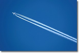
Weather Topic: What are Contrails?
Home - Education - Cloud Types - Contrails
 Next Topic: Cumulonimbus Clouds
A contrail is an artificial cloud, created by the passing of an
aircraft.
Contrails form because water vapor in the exhaust of aircraft engines is suspended
in the air under certain temperatures and humidity conditions. These contrails
are called exhaust contrails.
Another type of contrail can form due to a temporary reduction in air pressure
moving over the plane's surface, causing condensation.
These are called aerodynamic contrails.
When you can see your breath on a cold day, it is also because of condensation.
The reason contrails last longer than the condensation from your breath is
because the water in contrails freezes into ice particles.
Next Topic: Cumulonimbus Clouds
Current conditions powered by WeatherAPI.com


