Weather Alert in Maryland
Winter Storm Warning issued February 22 at 2:56AM EST until February 23 at 6:00PM EST by NWS Mount Holly NJ
AREAS AFFECTED: Kent
DESCRIPTION: ...POTENTIALLY HISTORIC WINTER STORM WILL IMPACT THE REGION THROUGH MONDAY... .A major winter storm is expected to develop today, impacting the region with very heavy, crippling snowfall and areas of blizzard conditions. Precipitation will develop today, changing to all snow this afternoon and evening. The most severe conditions and heaviest snowfall will occur tonight, with snow gradually tapering off during the daytime Monday. Record breaking snowfall totals are possible. * WHAT...Heavy snow expected. Total snow accumulations between 12 and 18 inches. Winds gusting as high as 40 mph. * WHERE...Kent MD County. * WHEN...From 10 AM this morning to 6 PM EST Monday. * IMPACTS...Travel could be very difficult to impossible. Blowing snow could significantly reduce visibility. The hazardous conditions will impact the Monday morning and evening commutes. Gusty winds could bring down tree branches and result in isolated power outages. * ADDITIONAL DETAILS...Snowfall rates could exceed 2 inches per hour. Locally higher snowfall amounts possible. Blowing and drifting of snow, and whiteout conditions possible.
INSTRUCTION: If you must travel, keep an extra flashlight, food, and water in your vehicle in case of an emergency. The latest road conditions for the state you are calling from can be obtained by calling 5 1 1.
Want more detail? Get the Complete 7 Day and Night Detailed Forecast!
Current U.S. National Radar--Current
The Current National Weather Radar is shown below with a UTC Time (subtract 5 hours from UTC to get Eastern Time).

National Weather Forecast--Current
The Current National Weather Forecast and National Weather Map are shown below.

National Weather Forecast for Tomorrow
Tomorrow National Weather Forecast and Tomorrow National Weather Map are show below.

North America Water Vapor (Moisture)
This map shows recent moisture content over North America. Bright and colored areas show high moisture (ie, clouds); brown indicates very little moisture present; black indicates no moisture.

Weather Topic: What is Condensation?
Home - Education - Precipitation - Condensation
 Next Topic: Contrails
Condensation is the process which creates clouds, and therefore
it is a crucial process in the water cycle.
Condensation is the change of matter from a state of gas into a state of liquid,
and it happens because water molecules release heat into the atmosphere and
become organized into a more closely packed structure, what we might see as
water droplets.
Water is always present in the air around us as a vapor, but it's too small for
us to see. When water undergoes the process of condensation it becomes organized
into visible water droplets. You've probably seen condensation happen before on the
surface of a cold drink!
Next Topic: Contrails
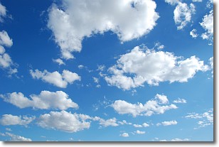
Weather Topic: What are Cumulonimbus Clouds?
Home - Education - Cloud Types - Cumulonimbus Clouds
 Next Topic: Cumulus Clouds
The final form taken by a growing cumulus cloud is the
cumulonimbus cloud, which is very tall and dense.
The tower of a cumulonimbus cloud can soar 23 km into the atmosphere, although
most commonly they stop growing at an altitude of 6 km.
Even small cumulonimbus clouds appear very large in comparison to other cloud types.
They can signal the approach of stormy weather, such as thunderstorms or blizzards.
Next Topic: Cumulus Clouds
Current conditions powered by WeatherAPI.com


