Weather Alert in New Jersey
Coastal Flood Advisory issued August 22 at 4:52AM EDT until August 23 at 5:00AM EDT by NWS Mount Holly NJ
AREAS AFFECTED: Gloucester; Camden; Northwestern Burlington; Delaware; Philadelphia; Lower Bucks
DESCRIPTION: * WHAT...Up to one foot of inundation above ground level in low- lying areas near shorelines and tidal waterways. * WHERE...In New Jersey, Gloucester, Camden and Northwestern Burlington. In Pennsylvania, Delaware, Philadelphia and Lower Bucks. * WHEN...Until 5 AM EDT Saturday. * IMPACTS...At this level, flooding begins on the most vulnerable roads along tidal waterways. Some partial or full road closures are possible.
INSTRUCTION: A Coastal Flood Advisory means that minor tidal flooding is expected. Minor tidal flooding often results in some road closures. Usually, the most vulnerable roadways will flood. Do not leave your vehicle at a location that is prone to tidal flooding. Do not drive your vehicle through flood waters. The water may be deeper than you think it is. You will be putting yourself in danger and your vehicle may be damaged, leading to costly repairs. Visit the Advanced Hydrologic Prediction Service at water.weather.gov/ahps for additional water level and flood impact information for your local tide gauge.
Want more detail? Get the Complete 7 Day and Night Detailed Forecast!
Current U.S. National Radar--Current
The Current National Weather Radar is shown below with a UTC Time (subtract 5 hours from UTC to get Eastern Time).

National Weather Forecast--Current
The Current National Weather Forecast and National Weather Map are shown below.

National Weather Forecast for Tomorrow
Tomorrow National Weather Forecast and Tomorrow National Weather Map are show below.

North America Water Vapor (Moisture)
This map shows recent moisture content over North America. Bright and colored areas show high moisture (ie, clouds); brown indicates very little moisture present; black indicates no moisture.

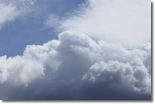
Weather Topic: What are Nimbostratus Clouds?
Home - Education - Cloud Types - Nimbostratus Clouds
 Next Topic: Precipitation
A nimbostratus cloud is similar to a stratus cloud in its formless,
smooth appearance. However, a nimbostratus cloud is darker than a stratus cloud,
because it is thicker.
Unlike a stratus cloud, a nimbostratus cloud typically brings with it the threat
of moderate to heavy precipitation. In some cases, the precipitation may evaporate
before reaching the ground, a phenomenon known as virga.
Next Topic: Precipitation
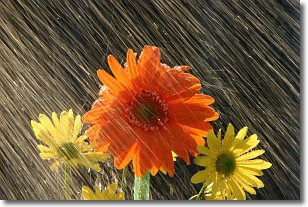
Weather Topic: What is Rain?
Home - Education - Precipitation - Rain
 Next Topic: Shelf Clouds
Precipitation in the form of water droplets is called rain.
Rain generally has a tendency to fall with less intensity over a greater period
of time, and when rainfall is more severe it is usually less sustained.
Rain is the most common form of precipitation and happens with greater frequency
depending on the season and regional influences. Cities have been shown to have
an observable effect on rainfall, due to an effect called the urban heat island.
Compared to upwind, monthly rainfall between twenty and forty miles downwind of
cities is 30% greater.
Next Topic: Shelf Clouds
Current conditions powered by WeatherAPI.com


