Weather Alert in Alaska
High Wind Watch issued February 24 at 5:31AM AKST until February 25 at 9:00PM AKST by NWS Anchorage AK
AREAS AFFECTED: Kodiak Island Northeast
DESCRIPTION: * WHAT...Northwest winds 35 to 50 mph with gusts up to 75 mph possible. Wind chills dropping as low as 15 below zero Wednesday morning. * WHERE...Northeast end of Kodiak Island, including Kodiak City. * WHEN...From late tonight through Wednesday evening. * IMPACTS...High winds could move loose debris, damage property, and cause power outages. Travel could be difficult. Wind chills as low as 15 below zero could result in hypothermia or frostbite if precautions are not taken. * ADDITIONAL DETAILS...The pattern is very similar to last Thursday night when Kodiak City observed high winds, with cold Arctic air surging across Kodiak Island Tuesday night through Wednesday. There is a subtle difference in the upper levels, with a disturbance possible passing just north of the island instead of passing overhead. Thus, winds in this upcoming event could be just a bit weaker than last Thursday night. The strongest winds are expected Wednesday morning.
INSTRUCTION: A high wind watch means there is potential for a hazardous high wind event. Monitor the latest forecasts and warnings for updates on this situation. Fasten loose objects or shelter objects in a safe location prior to the onset of winds.
Want more detail? Get the Complete 7 Day and Night Detailed Forecast!
Current U.S. National Radar--Current
The Current National Weather Radar is shown below with a UTC Time (subtract 5 hours from UTC to get Eastern Time).

National Weather Forecast--Current
The Current National Weather Forecast and National Weather Map are shown below.

National Weather Forecast for Tomorrow
Tomorrow National Weather Forecast and Tomorrow National Weather Map are show below.

North America Water Vapor (Moisture)
This map shows recent moisture content over North America. Bright and colored areas show high moisture (ie, clouds); brown indicates very little moisture present; black indicates no moisture.

Weather Topic: What are Stratocumulus Clouds?
Home - Education - Cloud Types - Stratocumulus Clouds
 Next Topic: Stratus Clouds
Stratocumulus clouds are similar to altocumulus clouds in their
fluffy appearance, but have a slightly darker shade due to their additional mass.
A good way to distinguish the two cloud types is to hold your hand out and measure
the size of an individual cloud; if it is the size of your thumb it is generally
an altocumulus cloud, if it is the size of your hand it is generally a
stratocumulus cloud.
It is uncommon for stratocumulus clouds to produce precipitation, but if they do
it is usually a light rain or snow.
Next Topic: Stratus Clouds
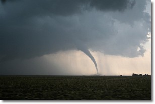
Weather Topic: What are Wall Clouds?
Home - Education - Cloud Types - Wall Clouds
 Next Topic: Altocumulus Clouds
A wall cloud forms underneath the base of a cumulonimbus cloud,
and can be a hotbed for deadly tornadoes.
Wall clouds are formed by air flowing into the cumulonimbus clouds, which can
result in the wall cloud descending from the base of the cumulonimbus cloud, or
rising fractus clouds which join to the base of the storm cloud as the wall cloud
takes shape.
Wall clouds can be very large, and in the Northern Hemisphere they generally
form at the southern edge of cumulonimbus clouds.
Next Topic: Altocumulus Clouds
Current conditions powered by WeatherAPI.com


