Weather Alert in Iowa
Winter Storm Warning issued February 19 at 10:45AM CST until February 20 at 6:00AM CST by NWS Des Moines IA
AREAS AFFECTED: Webster; Crawford; Carroll; Greene; Boone; Audubon; Guthrie; Dallas; Cass
DESCRIPTION: Precipitation will spread from western into central Iowa this afternoon and evening. Initially, it may begin as a rain/snow mix across southern and western Iowa before changing to snow. A band of 5 to 8 inches of snow is expected by Friday morning from western through central to northeastern Iowa. There will be a sharp gradient of snowfall on either side of the heaviest band of snow. Snow rates may exceed 1" per hour at times this evening leading to rapid snow accumulations on roads and slick travel conditions. A small change in the location of the band could alter forecast snow amounts. * WHAT...Heavy snow expected. Total snow accumulations between 5 and 8 inches. * WHERE...Portions of western and central Iowa. * WHEN...From 3 PM this afternoon to 6 AM CST Friday. * IMPACTS...Travel could be very difficult. The hazardous conditions could impact the Thursday evening commute.
INSTRUCTION: If you must travel, keep an extra flashlight, food, and water in your vehicle in case of an emergency. For the latest travel conditions, check the Iowa 511 app, www.511ia.org, or dial 511.
Want more detail? Get the Complete 7 Day and Night Detailed Forecast!
Current U.S. National Radar--Current
The Current National Weather Radar is shown below with a UTC Time (subtract 5 hours from UTC to get Eastern Time).

National Weather Forecast--Current
The Current National Weather Forecast and National Weather Map are shown below.

National Weather Forecast for Tomorrow
Tomorrow National Weather Forecast and Tomorrow National Weather Map are show below.

North America Water Vapor (Moisture)
This map shows recent moisture content over North America. Bright and colored areas show high moisture (ie, clouds); brown indicates very little moisture present; black indicates no moisture.

Weather Topic: What is Drizzle?
Home - Education - Precipitation - Drizzle
 Next Topic: Evaporation
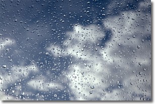
Drizzle is precipitation in the form of water droplets which are
smaller than raindrops.
Drizzle is characterized by fine, gently falling droplets and typically does not
impact human habitation in a negative way. The exception to this is freezing drizzle,
a condition where drizzle freezes immediately upon reaching earth's surface.
Freezing drizzle is still less dangerous than freezing rain, but can
potentially result in hazardous road conditions.
Next Topic: Evaporation
Weather Topic: What is Fog?
Home - Education - Cloud Types - Fog
 Next Topic: Fractus Clouds
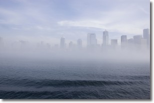
Fog is technically a type of stratus cloud, which lies along the
ground and obscures visibility.
It is usually created when humidity in the air condenses into tiny water droplets.
Because of this, some places are more prone to foggy weather, such as regions
close to a body of water.
Fog is similar to mist; both are the appearance of water droplets suspended in
the air, but fog is the term applied to the condition when visibility is less than 1 km.
Next Topic: Fractus Clouds
Current conditions powered by WeatherAPI.com


