Weather Alert in New Jersey
Extreme Cold Watch issued February 5 at 1:03PM EST until February 8 at 1:00PM EST by NWS Upton NY
AREAS AFFECTED: Hudson; Western Essex; Eastern Essex; Western Union; Eastern Union; New York (Manhattan); Bronx; Richmond (Staten Is.); Kings (Brooklyn); Northwest Suffolk; Northeast Suffolk; Southwest Suffolk; Southeast Suffolk; Northern Queens; Northern Nassau; Southern Queens; Southern Nassau
DESCRIPTION: * WHAT...Dangerously cold wind chills of 15 below possible. * WHERE...Portions of northeast New Jersey and southeast New York. * WHEN...From Saturday evening through early Sunday afternoon. * IMPACTS...The cold wind chills could result in hypothermia if precautions are not taken.
INSTRUCTION: Dress in layers including a hat, face mask, and gloves if you must go outside. To prevent freezing and possible bursting of outdoor water pipes they should be wrapped, drained, or allowed to drip slowly. Those that have in-ground sprinkler systems should drain them and cover above-ground pipes to protect them from freezing. Keep pets indoors as much as possible. Make frequent checks on older family, friends, and neighbors. Ensure portable heaters are used correctly. Do not use generators or grills inside. Monitor the latest forecasts and warnings for updates.
Want more detail? Get the Complete 7 Day and Night Detailed Forecast!
Current U.S. National Radar--Current
The Current National Weather Radar is shown below with a UTC Time (subtract 5 hours from UTC to get Eastern Time).

National Weather Forecast--Current
The Current National Weather Forecast and National Weather Map are shown below.

National Weather Forecast for Tomorrow
Tomorrow National Weather Forecast and Tomorrow National Weather Map are show below.

North America Water Vapor (Moisture)
This map shows recent moisture content over North America. Bright and colored areas show high moisture (ie, clouds); brown indicates very little moisture present; black indicates no moisture.

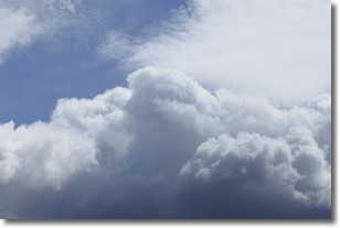
Weather Topic: What are Nimbostratus Clouds?
Home - Education - Cloud Types - Nimbostratus Clouds
 Next Topic: Precipitation
A nimbostratus cloud is similar to a stratus cloud in its formless,
smooth appearance. However, a nimbostratus cloud is darker than a stratus cloud,
because it is thicker.
Unlike a stratus cloud, a nimbostratus cloud typically brings with it the threat
of moderate to heavy precipitation. In some cases, the precipitation may evaporate
before reaching the ground, a phenomenon known as virga.
Next Topic: Precipitation
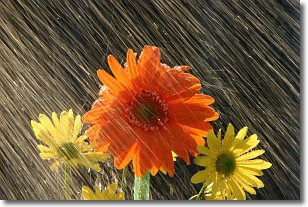
Weather Topic: What is Rain?
Home - Education - Precipitation - Rain
 Next Topic: Shelf Clouds
Precipitation in the form of water droplets is called rain.
Rain generally has a tendency to fall with less intensity over a greater period
of time, and when rainfall is more severe it is usually less sustained.
Rain is the most common form of precipitation and happens with greater frequency
depending on the season and regional influences. Cities have been shown to have
an observable effect on rainfall, due to an effect called the urban heat island.
Compared to upwind, monthly rainfall between twenty and forty miles downwind of
cities is 30% greater.
Next Topic: Shelf Clouds
Current conditions powered by WeatherAPI.com


