Weather Alert in New York
Winter Weather Advisory issued February 20 at 1:30AM EST until February 21 at 10:00AM EST by NWS Burlington VT
AREAS AFFECTED: Northern Franklin; Southeastern St. Lawrence; Southwestern St. Lawrence; Grand Isle; Western Franklin; Orleans; Essex; Western Chittenden; Lamoille; Caledonia; Washington; Western Addison; Western Rutland; Eastern Franklin; Eastern Chittenden
DESCRIPTION: * WHAT...Snow expected. Total snow accumulations between 3 and 7 inches. * WHERE...Portions of northern New York and Vermont. * WHEN...From 10 AM this morning to 10 AM EST Saturday. * IMPACTS...Travel could be very difficult. The hazardous conditions could impact the Friday evening commute. * ADDITIONAL DETAILS...Sections of the Northeast Kingdom are less likely to see snow arrive by the evening commute. Travel impacts are less likely across this area. Initially wet snow and 1"/hr rates are possible this evening before trending lighter. Isolated power outages could occur.
INSTRUCTION: Slow down and use caution while traveling. For the latest on road conditions in Vermont, visit https://newengland511.org and for New York, visit https://511ny.org.
Want more detail? Get the Complete 7 Day and Night Detailed Forecast!
Current U.S. National Radar--Current
The Current National Weather Radar is shown below with a UTC Time (subtract 5 hours from UTC to get Eastern Time).

National Weather Forecast--Current
The Current National Weather Forecast and National Weather Map are shown below.

National Weather Forecast for Tomorrow
Tomorrow National Weather Forecast and Tomorrow National Weather Map are show below.

North America Water Vapor (Moisture)
This map shows recent moisture content over North America. Bright and colored areas show high moisture (ie, clouds); brown indicates very little moisture present; black indicates no moisture.

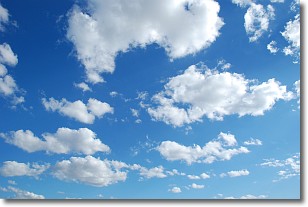
Weather Topic: What are Cumulonimbus Clouds?
Home - Education - Cloud Types - Cumulonimbus Clouds
 Next Topic: Cumulus Clouds
The final form taken by a growing cumulus cloud is the
cumulonimbus cloud, which is very tall and dense.
The tower of a cumulonimbus cloud can soar 23 km into the atmosphere, although
most commonly they stop growing at an altitude of 6 km.
Even small cumulonimbus clouds appear very large in comparison to other cloud types.
They can signal the approach of stormy weather, such as thunderstorms or blizzards.
Next Topic: Cumulus Clouds
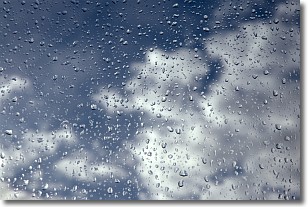
Weather Topic: What is Drizzle?
Home - Education - Precipitation - Drizzle
 Next Topic: Evaporation
Drizzle is precipitation in the form of water droplets which are
smaller than raindrops.
Drizzle is characterized by fine, gently falling droplets and typically does not
impact human habitation in a negative way. The exception to this is freezing drizzle,
a condition where drizzle freezes immediately upon reaching earth's surface.
Freezing drizzle is still less dangerous than freezing rain, but can
potentially result in hazardous road conditions.
Next Topic: Evaporation
Current conditions powered by WeatherAPI.com


