Weather Alert in Washington
Fire Weather Watch issued July 29 at 4:31AM PDT until July 30 at 9:00PM PDT by NWS Spokane WA
AREAS AFFECTED: East Washington Central Cascades
DESCRIPTION: ...HOT, DRY, AND UNSTABLE CONDITIONS WITH ISOLATED DRY THUNDERSTORMS WEDNESDAY AFTERNOON AND EVENING... * Affected Area: East Washington Central Cascades (Zone 696). * Timing: Wednesday afternoon and evening. * Relative Humidities: 15 to 25 percent. * Temperatures: 80-90 degrees. * Lightning: Isolated dry thunderstorms. * Outflow Winds: Gusty and erratic winds are possible with any thunderstorms that develop. The outflow winds could travel quite a distance from the core of the storm. * Impacts: Hot, dry, and unstable conditions Wednesday afternoon and evening may lead to rapid fire growth on any new or existing fires. Isolated dry thunderstorms will lead to the potential for new fire starts. Gusty winds with thunderstorms may result in rapid fire spread with any new or existing fires.
INSTRUCTION: A Fire Weather Watch means that critical fire weather conditions are forecast to occur. Listen for later forecasts and possible Red Flag Warnings.
Want more detail? Get the Complete 7 Day and Night Detailed Forecast!
Current U.S. National Radar--Current
The Current National Weather Radar is shown below with a UTC Time (subtract 5 hours from UTC to get Eastern Time).

National Weather Forecast--Current
The Current National Weather Forecast and National Weather Map are shown below.

National Weather Forecast for Tomorrow
Tomorrow National Weather Forecast and Tomorrow National Weather Map are show below.

North America Water Vapor (Moisture)
This map shows recent moisture content over North America. Bright and colored areas show high moisture (ie, clouds); brown indicates very little moisture present; black indicates no moisture.

Weather Topic: What is Condensation?
Home - Education - Precipitation - Condensation
 Next Topic: Contrails
Condensation is the process which creates clouds, and therefore
it is a crucial process in the water cycle.
Condensation is the change of matter from a state of gas into a state of liquid,
and it happens because water molecules release heat into the atmosphere and
become organized into a more closely packed structure, what we might see as
water droplets.
Water is always present in the air around us as a vapor, but it's too small for
us to see. When water undergoes the process of condensation it becomes organized
into visible water droplets. You've probably seen condensation happen before on the
surface of a cold drink!
Next Topic: Contrails
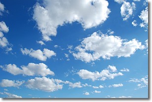
Weather Topic: What are Cumulonimbus Clouds?
Home - Education - Cloud Types - Cumulonimbus Clouds
 Next Topic: Cumulus Clouds
The final form taken by a growing cumulus cloud is the
cumulonimbus cloud, which is very tall and dense.
The tower of a cumulonimbus cloud can soar 23 km into the atmosphere, although
most commonly they stop growing at an altitude of 6 km.
Even small cumulonimbus clouds appear very large in comparison to other cloud types.
They can signal the approach of stormy weather, such as thunderstorms or blizzards.
Next Topic: Cumulus Clouds
Current conditions powered by WeatherAPI.com


