Weather Alert in California
Winter Storm Warning issued February 19 at 12:25AM PST until February 19 at 10:00AM PST by NWS Medford OR
AREAS AFFECTED: Western Siskiyou County
DESCRIPTION: * WHAT...Heavy snow. Additional snow accumulations 4 to 12 inches at elevations above 3000 feet and 1 to 5 inches at elevations below 3000 feet. Snow levels near 2000 feet will fall to valley floors overnight. A majority of the snow is expected between Midnight and 7 AM PST Thursday morning, with light snow showers then tapering off through the morning. * WHERE...In western Siskiyou County. This includes all of Highway 96 and 3, and Etna Summit on Sawyers Bar Rd. This also includes the Klamath River and Scott Valleys, the communities of Happy Camp, Somes Bar, Etna, Greenview, and Callahan. * WHEN...Until 10 AM PST this morning. * IMPACTS...Travel may be difficult to impossible, especially at higher elevations. * ADDITIONAL DETAILS...Visit weather.gov/mfr/winter for additional snow probabilities
INSTRUCTION: If you must travel, keep an extra flashlight, food, and water in your vehicle in case of an emergency. Call 511 or visit quickmap.dot.ca.gov for road information.
Want more detail? Get the Complete 7 Day and Night Detailed Forecast!
Current U.S. National Radar--Current
The Current National Weather Radar is shown below with a UTC Time (subtract 5 hours from UTC to get Eastern Time).

National Weather Forecast--Current
The Current National Weather Forecast and National Weather Map are shown below.

National Weather Forecast for Tomorrow
Tomorrow National Weather Forecast and Tomorrow National Weather Map are show below.

North America Water Vapor (Moisture)
This map shows recent moisture content over North America. Bright and colored areas show high moisture (ie, clouds); brown indicates very little moisture present; black indicates no moisture.

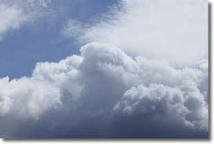
Weather Topic: What are Nimbostratus Clouds?
Home - Education - Cloud Types - Nimbostratus Clouds
 Next Topic: Precipitation
A nimbostratus cloud is similar to a stratus cloud in its formless,
smooth appearance. However, a nimbostratus cloud is darker than a stratus cloud,
because it is thicker.
Unlike a stratus cloud, a nimbostratus cloud typically brings with it the threat
of moderate to heavy precipitation. In some cases, the precipitation may evaporate
before reaching the ground, a phenomenon known as virga.
Next Topic: Precipitation
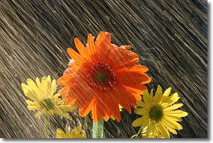
Weather Topic: What is Rain?
Home - Education - Precipitation - Rain
 Next Topic: Shelf Clouds
Precipitation in the form of water droplets is called rain.
Rain generally has a tendency to fall with less intensity over a greater period
of time, and when rainfall is more severe it is usually less sustained.
Rain is the most common form of precipitation and happens with greater frequency
depending on the season and regional influences. Cities have been shown to have
an observable effect on rainfall, due to an effect called the urban heat island.
Compared to upwind, monthly rainfall between twenty and forty miles downwind of
cities is 30% greater.
Next Topic: Shelf Clouds
Current conditions powered by WeatherAPI.com


