Weather Alert in Oregon
High Surf Advisory issued February 21 at 1:47PM PST until February 22 at 10:00AM PST by NWS Medford OR
AREAS AFFECTED: South Central Oregon Coast; Curry County Coast
DESCRIPTION: * WHAT...Large breaking waves of 23 to 27 feet. Surf heights are expected to reach a peak early Sunday morning. Waves will be highest on south and southwest facing beaches. * WHERE...South Central Oregon Coast and Curry County Coast. * WHEN...From 10 PM this evening to 10 AM PST Sunday. * IMPACTS...Large breaking waves will create hazardous conditions along and within the surf zone, and could inundate beaches and low lying shorelines. Beach erosion is possible, and exposed infrastructure may be damaged. * View the hazard area in detail at https://www.wrh.noaa.gov/map/?wfo=mfr
INSTRUCTION: Stay away from the surf zone and off of jetties. Area beaches may become hazardous due to dangerous surf conditions.
Want more detail? Get the Complete 7 Day and Night Detailed Forecast!
Current U.S. National Radar--Current
The Current National Weather Radar is shown below with a UTC Time (subtract 5 hours from UTC to get Eastern Time).

National Weather Forecast--Current
The Current National Weather Forecast and National Weather Map are shown below.

National Weather Forecast for Tomorrow
Tomorrow National Weather Forecast and Tomorrow National Weather Map are show below.

North America Water Vapor (Moisture)
This map shows recent moisture content over North America. Bright and colored areas show high moisture (ie, clouds); brown indicates very little moisture present; black indicates no moisture.

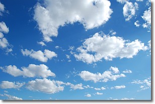
Weather Topic: What are Cumulonimbus Clouds?
Home - Education - Cloud Types - Cumulonimbus Clouds
 Next Topic: Cumulus Clouds
The final form taken by a growing cumulus cloud is the
cumulonimbus cloud, which is very tall and dense.
The tower of a cumulonimbus cloud can soar 23 km into the atmosphere, although
most commonly they stop growing at an altitude of 6 km.
Even small cumulonimbus clouds appear very large in comparison to other cloud types.
They can signal the approach of stormy weather, such as thunderstorms or blizzards.
Next Topic: Cumulus Clouds
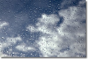
Weather Topic: What is Drizzle?
Home - Education - Precipitation - Drizzle
 Next Topic: Evaporation
Drizzle is precipitation in the form of water droplets which are
smaller than raindrops.
Drizzle is characterized by fine, gently falling droplets and typically does not
impact human habitation in a negative way. The exception to this is freezing drizzle,
a condition where drizzle freezes immediately upon reaching earth's surface.
Freezing drizzle is still less dangerous than freezing rain, but can
potentially result in hazardous road conditions.
Next Topic: Evaporation
Current conditions powered by WeatherAPI.com


