Weather Alert in Minnesota
Flood Warning issued June 13 at 9:14AM CDT until June 14 at 9:15AM CDT by NWS Aberdeen SD
AREAS AFFECTED: Big Stone, MN; Roberts, SD
DESCRIPTION: * WHAT...Flooding caused by excessive rainfall is occurring. * WHERE...Portions of west central Minnesota, including the following county, Big Stone and northeast South Dakota, including the following county, Roberts. * WHEN...Until 915 AM CDT Saturday. * IMPACTS...Flooding of rivers, creeks, streams, and other low-lying and flood-prone locations is imminent or occurring. Numerous roads remain closed due to flooding. Expect many areas of slow moving or standing water. * ADDITIONAL DETAILS... - At 905 AM CDT, Emergency Management reported flooding in the warned area. Flooding is already occurring. Several streets in Sisseton, as well as many county and township roads across Roberts and Big Stone counties are either closed or affected by standing water. Between 3 and 6 inches of rain have fallen, with locally higher amounts in excess of 7 inches. - Flooding impacts will continue, but no additional rainfall is expected. - Some locations that will experience flooding include... Sisseton, Agency Village, Browns Valley, Wilmot, Clinton, Peever, Peever Flats Housing, Yankeetown, Bonanza Grove, Dakota Connection & Casino, Finley Heights Housing, Big Stone Lake, Lake Traverse, Lismore Colony, Lagoona Beach and Lake Traverse Reservation. - http://www.weather.gov/safety/flood
INSTRUCTION: Turn around, don't drown when encountering flooded roads. Most flood deaths occur in vehicles. Please report observed flooding to local emergency services or law enforcement and request they pass this information to the National Weather Service when you can do so safely.
Want more detail? Get the Complete 7 Day and Night Detailed Forecast!
Current U.S. National Radar--Current
The Current National Weather Radar is shown below with a UTC Time (subtract 5 hours from UTC to get Eastern Time).

National Weather Forecast--Current
The Current National Weather Forecast and National Weather Map are shown below.

National Weather Forecast for Tomorrow
Tomorrow National Weather Forecast and Tomorrow National Weather Map are show below.

North America Water Vapor (Moisture)
This map shows recent moisture content over North America. Bright and colored areas show high moisture (ie, clouds); brown indicates very little moisture present; black indicates no moisture.

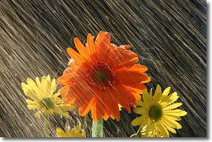
Weather Topic: What is Rain?
Home - Education - Precipitation - Rain
 Next Topic: Shelf Clouds
Precipitation in the form of water droplets is called rain.
Rain generally has a tendency to fall with less intensity over a greater period
of time, and when rainfall is more severe it is usually less sustained.
Rain is the most common form of precipitation and happens with greater frequency
depending on the season and regional influences. Cities have been shown to have
an observable effect on rainfall, due to an effect called the urban heat island.
Compared to upwind, monthly rainfall between twenty and forty miles downwind of
cities is 30% greater.
Next Topic: Shelf Clouds
Weather Topic: What is Sleet?
Home - Education - Precipitation - Sleet
 Next Topic: Snow
Sleet is a form of precipitation in which small ice pellets are the primary
components. These ice pellets are smaller and more translucent than hailstones,
and harder than graupel. Sleet is caused by specific atmospheric conditions and
therefore typically doesn't last for extended periods of time.
The condition which leads to sleet formation requires a warmer body of air to be
wedged in between two sub-freezing bodies of air. When snow falls through a warmer
layer of air it melts, and as it falls through the next sub-freezing body of air
it freezes again, forming ice pellets known as sleet. In some cases, water
droplets don't have time to freeze before reaching the surface and the result is
freezing rain.
Next Topic: Snow
Current conditions powered by WeatherAPI.com


